↓
 

Oklahoma City Land Surveying

...local Land Surveyors in the OKC metro area.

Oklahoma City Land Surveying
(405) 546-2121
Oklahoma City Land Surveying
  • Home
  • Civil Engineering
    • Flood Determination
    • Expert Witness
  • Construction Surveying
  • Drone LiDAR Mapping
  • ALTA Title Survey
  • Lot Survey
  • Topographic Survey | Topo Survey
  • Elevation Certificate
  • Land Surveying
  • Boundary Surveying
  • About Us
  • Locations
    • Columbiana
  • Contact Us
Home→elevation certificate→Difference in FEMA Elevation Certificate and LOMA →GIS with Flood Hazard Zone Overlay

Image navigation

Next →

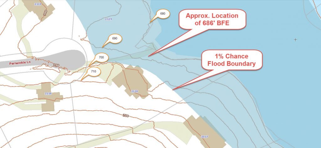
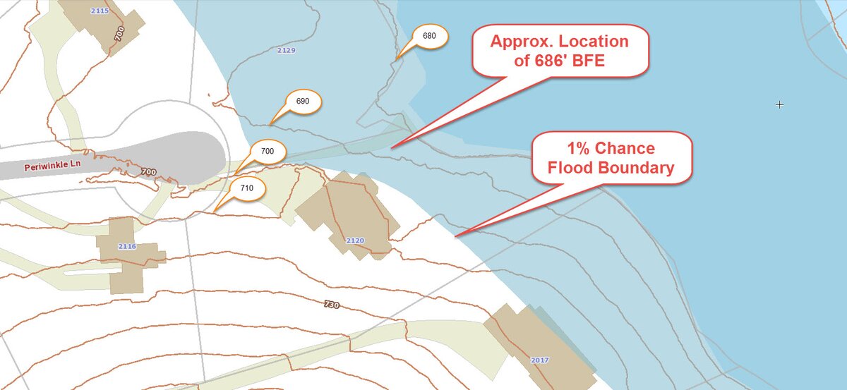
GIS with Flood Hazard Zone Overlay

Published March 6, 2016 at 1605 × 740 in Difference in FEMA Elevation Certificate and LOMA

Image navigation

Next →
Get Quote Button

Categories

  • ALTA Land Title Survey
  • blog
  • boundary survey
  • elevation certificate
  • flood survey
  • land surveying
  • land surveyor
  • property encroachment
  • subdivision
  • topographic survey
  • Uncategorized
© Copyright Oklahoma City Land Surveying
Oklahoma City, OK
Phone: (405) 546-2121

Privacy Policy | Terms of Use
Web Development and SEO by: AuburnBusiness.com

The owner of this website, USA Surveying & Engineering, LLC., provides coordination of professional land surveying and engineering services in all 50 states. The professional surveying and engineering services provided to you will be conducted by fully licensed professionals in your state.

Privacy Policy
↑