
Property Survey Before Turning a Large Backyard Into a Second Homesite
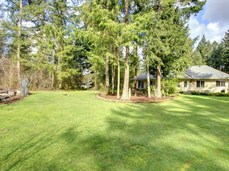
A big backyard can look like a wide-open space. Once it’s measured, though, the buildable area is often smaller than it seems. Fences sit off the true line, utility easements cut across the rear, and setback rules take a bite out of every side.
A property survey is a professionally measured map of your land that shows its boundaries, existing improvements, and recorded features. Get one done before you sketch a second home. It tells you how much room you really have, what limits apply, and where a new house can safely go.
Confirm the Backyard’s Existing Property Boundaries
The first job is finding exactly where your land ends. A boundary survey locates your property corners, measures the lines between them, and compares them to your deed and recorded plat. That gives you a reliable starting point for every decision that follows.
Fences, hedges, and old sheds are poor guides. Many were placed by eye decades ago, and some sit several feet off the true line. If a neighbor’s fence or driveway crosses onto your land, or yours crosses onto theirs, the survey will show it before it turns into a building problem.
Documents to Gather First
Pull together your deed, any older surveys, and your closing papers before the surveyor starts. These records speed up research and can explain odd lines or angles. Tell the surveyor up front that you’re planning a second homesite so they include the details your designer will need.
Map the Space Available for a Second Homesite
Once the lines are set, the surveyor maps what’s already on the lot. This usually includes the main house, garage, driveway, patio, pool, large trees, and outbuildings. Each one takes up space and affects where a second home can fit.
The result is a scaled drawing your designer can work from. You’ll see the true size and shape of the open area instead of guessing. Many owners find that a wide backyard narrows quickly once the existing house and driveway are drawn to scale.
Think early about how the land will be used. Some owners want a separate lot, while others plan a second dwelling on the same parcel. Rules for each option can vary by municipality and zoning district, so confirm the path with your local planning office before design work begins.
Identify Setbacks, Easements, and Access Constraints
Setbacks, easements, and access often decide whether a second homesite works at all. A setback is the required distance between a building and a property line. An easement is a recorded right that lets someone else use part of your land, such as a utility company running power or sewer lines.
A survey can help reveal items like these:
- Recorded utility, drainage, or access easements that limit where you can build
- Overhead power lines and visible utility features
- Possible routes for a second driveway to reach the street
- Encroachments by fences, sheds, or neighboring structures
The surveyor can plot recorded easements when a title report is available. Setback distances come from local zoning rules and can differ by lot type and district. Ask your surveyor and planning office to confirm them before you commit to a layout.
Access deserves a close look too. Fire crews, delivery trucks, and future owners all need a clear route to the new home. If the only path runs along a narrow side yard, the survey will show whether there’s enough width to work with.
Evaluate Elevations and Drainage Before Site Planning
A topographic survey maps the high and low spots across your yard. It shows ground elevations, slopes, and features like ditches and swales. That information shapes where the house sits, how the foundation is built, and where water will flow.
A new roof, driveway, and patio add hard surfaces that send more runoff downhill. If that water heads toward the main house or a neighbor’s yard, you’ll be dealing with wet crawlspaces and unhappy neighbors later. Good elevation data lets your team plan for it now.
The survey can also help show whether part of the property sits near a mapped floodplain. Flood maps and local drainage rules vary, and an engineer may need to review the site. Getting elevations early gives them time to plan grading before the design is locked in.
Use Survey Data to Coordinate the New Homesite
A property survey only pays off when everyone works from it. Share it with your architect, civil engineer, builder, and utility providers. When they all use the same measurements, fewer mistakes slip through.
Your designer can place the new home inside the setbacks and outside any easements. Your engineer can plan grading, drainage, and utility connections from the elevations. Once plans are approved, the surveyor can return to stake the house corners so the builder pours the foundation in the right spot.
Permit offices may ask for a site plan based on a current survey. Requirements differ by municipality and project scope, so ask what they need before you order anything. If a permit deadline or construction start depends on the survey, schedule it early.
Frequently Asked Questions
Do I need a property survey to build a second home on my lot?
Many permit offices ask for a site plan drawn from a current survey. Even when it isn’t required, a survey helps you avoid building too close to a line or on top of an easement. Requirements vary by municipality and project type. Check with your local planning office before you start design.
Can I use the survey from when I bought my house?
An older survey can be a helpful starting point. It may not show recent changes like new fences, additions, or newly recorded easements. Building projects often need more detail than a purchase survey provides. A licensed surveyor can review it and tell you whether an update will work.
What’s the difference between a boundary survey and a topographic survey?
A boundary survey locates your property lines and corners. A topographic survey maps ground elevations, slopes, and surface features. Planning a second homesite usually calls for both kinds of information. Many surveyors can combine them into one project.
How much of my backyard can I build on?
That depends on your lot size, setbacks, easements, and local zoning rules. A survey shows the true open area after existing buildings and recorded limits are mapped. Your planning office can confirm which rules apply to your lot. Together, these define your building envelope, which is the area where a new structure is allowed to go.
How long does a survey for a second homesite take?
Many residential surveys take one to three weeks. Adding topographic mapping or extra record research can stretch that timeline. Weather and busy seasons also affect scheduling. Order the survey early if design or permits depend on it.
